Accommodation Baviaanskloof Info What to see Activities Where to Eat Travel Times & Distances Day Visitors Geology Mammals Reptiles & Fish Bird Life Flora Photo Gallery
What to see in the Baviaanskloof
History, the Route and General Information
The dirt road was built between 1880 and 1890 by South Africa's most famous road engineer, Thomas Bain. Together with his father, Andrew Geddes Bain, who emigrated from Scotland in 1816, he was responsible for 32 of the most important road projects in the Cape. It was among the last roads built by Bain (he died in 1893) and it is by far the longest of the roads and mountain passes which bear his mark.
Although not in the same engineering league as his routes over the Swartberg or Outeniqua ranges, it can be compared with the Tsitsikamma forest road, which, incidentally, was its inspiration.
While the forest road was being completed in the early 1880's, Bain was already arguing for connecting roads to the east-west highway, which would make it more accessible and valuable to the rest of the country.
The Baviaanskloof road stretches from Patensie in the east to Willowmore in the west (197 Km’s) and nature lovers taking the untarred road find an almost pristine wilderness.
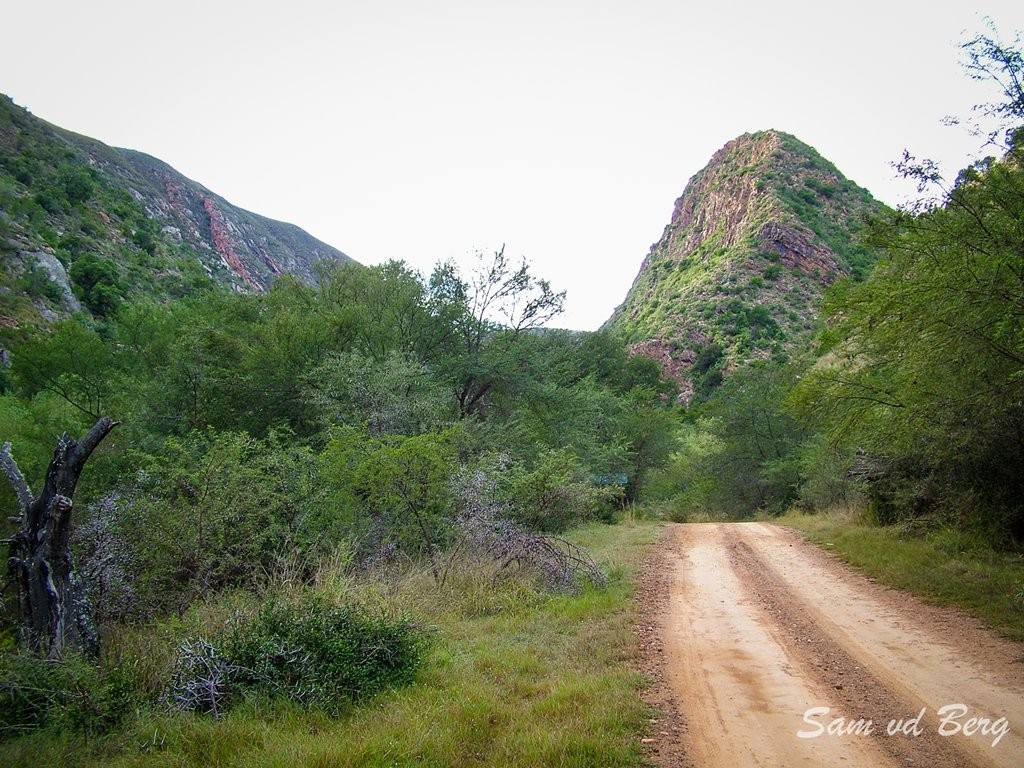
The road itself is spectacular but very rough in parts. The seasonal rain can sometimes cause wash-aways and it is recommended only for bakkies and 4x4’s.
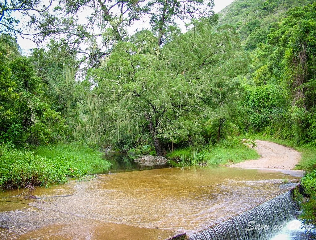
Along the way two majestic mountain passes are crossed and numerous low water bridges are encountered. During the rainy season this causes considerable delays!
The Route
After leaving Patensie, the almost 1 800m summit of Cockscomb looms ahead. It is named after the five jagged crests resembling a rooster's comb. A right turn off the main road at Cockscomb introduces the Goede Hoop-Sandrivier area to hikers, anglers, campers and four-wheel drivers.
At Andrieskraal (16 km from Patensie), the bust of Queen Victoria rises out of the cemented matrix of water-borne pebbles known as Enon conglomerate.
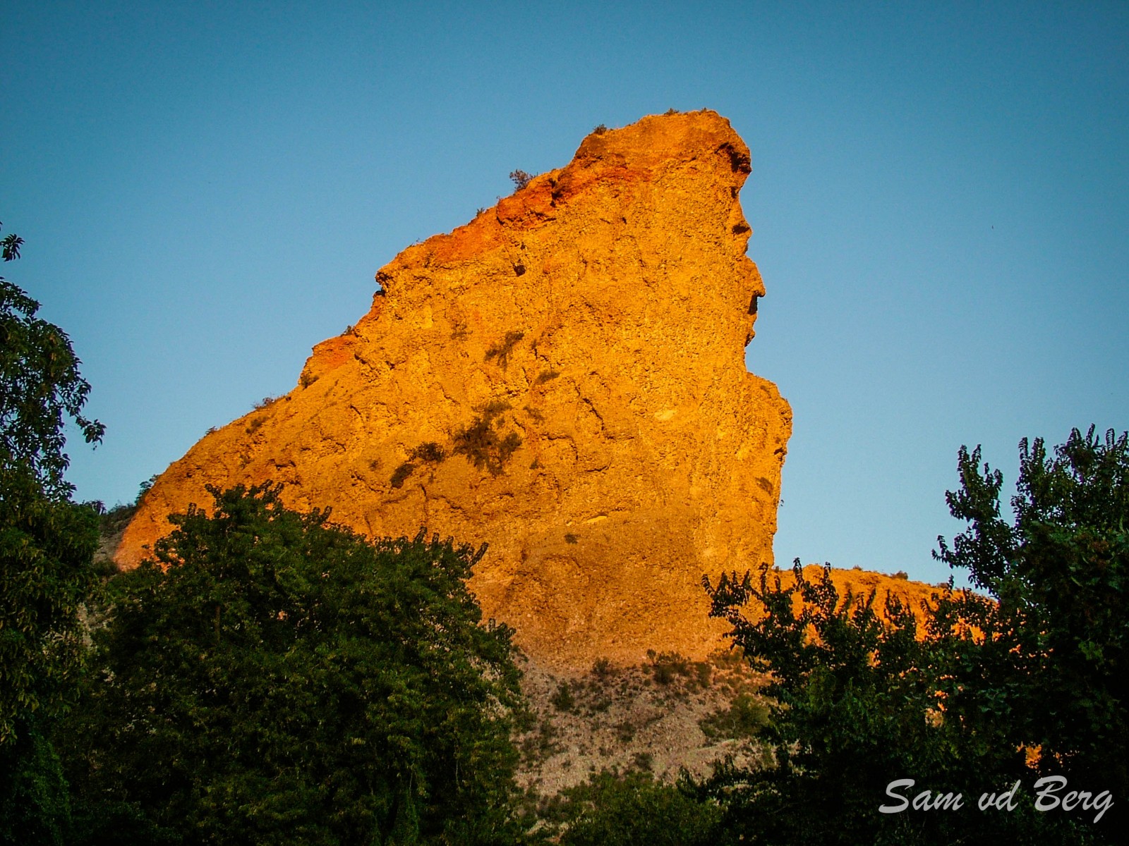 Queen Victoria at sunrise
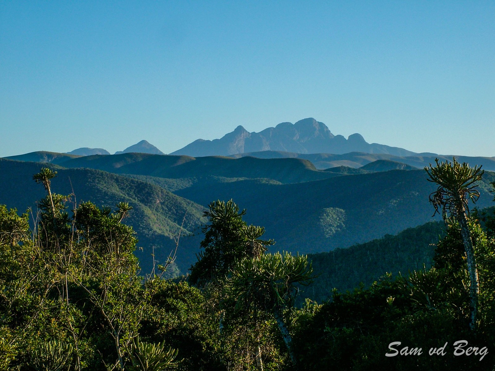 The Cockscomb Mountain
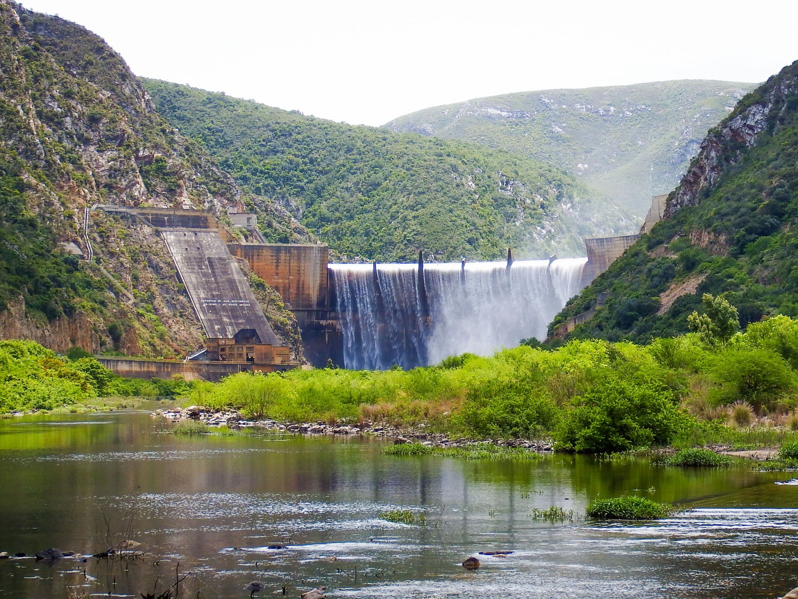 The Kouga Dam
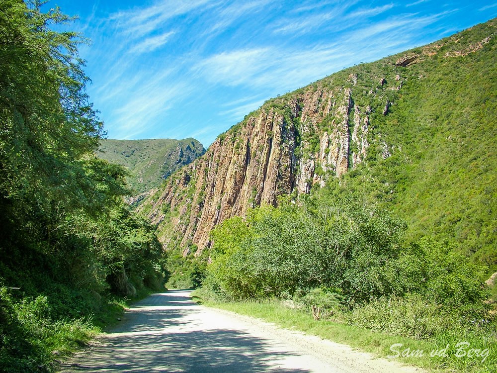 Rock Formations - Grootrivier Gorge
The road cuttings in the area are characterised by sheer cliffs of the same geological formation. A slight detour of 7km to the Kouga Dam leads to the life source of the Gamtoos Valley and the Port Elizabeth Metropolitan area. Representing the first ever double-arched dam built in South Africa, its waters stretch for a tranquil 28km up into the mountain wilderness.
After passing the Komdomo camping ground the road winds for 10km through the Grootrivier poort past exquisite rock formations deeply incised by the Grootrivier.
Pinnacles, overhangs and slabs of Table Mountain Sandstone adorned with luminous lichens usher travelers into the splendour of the Kouga-Baviaans mountain catchment area.
Cambria, affectionally known as "Die Kas" because of the "boxed-in" configuration of the area, produces some of the sweetest citrus fruit in the region. The name Cambria was bestowed on the area by an early Welsh visitor who was struck by its resemblance to his homeland.
The Poortjies Valley, watered by the pristine Witrivier and clothed in mystical remnants of Knysna Forest, represents the portal to the true wilderness area. Tread lightly as this ecologically sensitive system contains a number of gems, including the delicate George Lily and the inquisitive freshwater fish, the Red-finned minnow.
After Poortjies comes the first pass: Combrinck's Pass. It's quite steep and narrow and as it snakes upwards there are some very tight turns with breathtaking drops and dramatic scenery. Speculate on the hardships endured by early the pioneers.
 Poortjies Valley
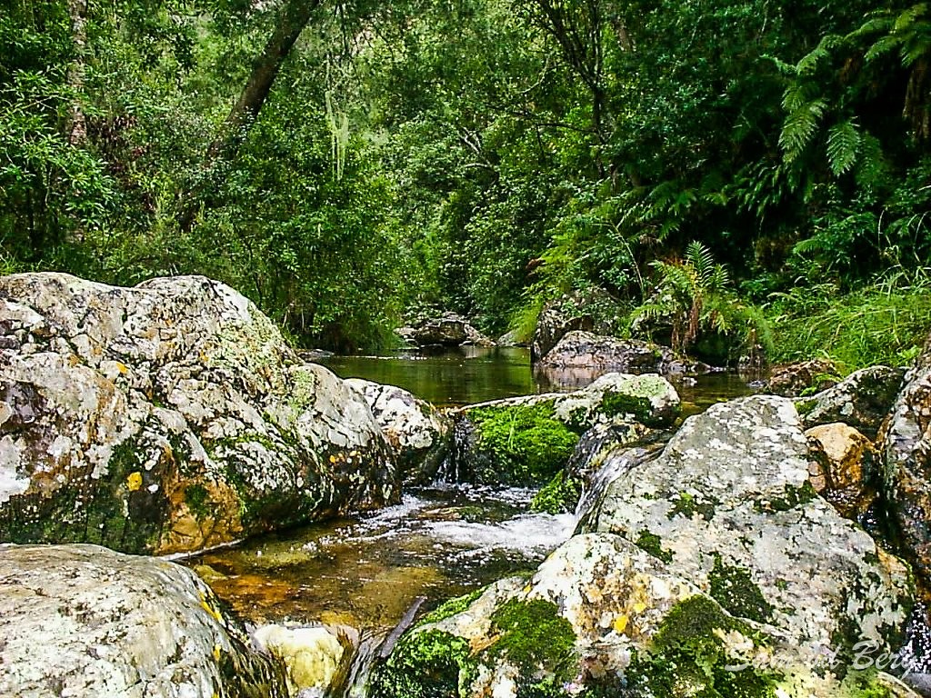 Poortjies Valley Wit River
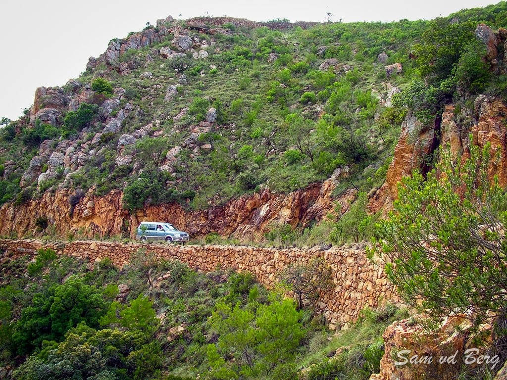 Combrinks Pass
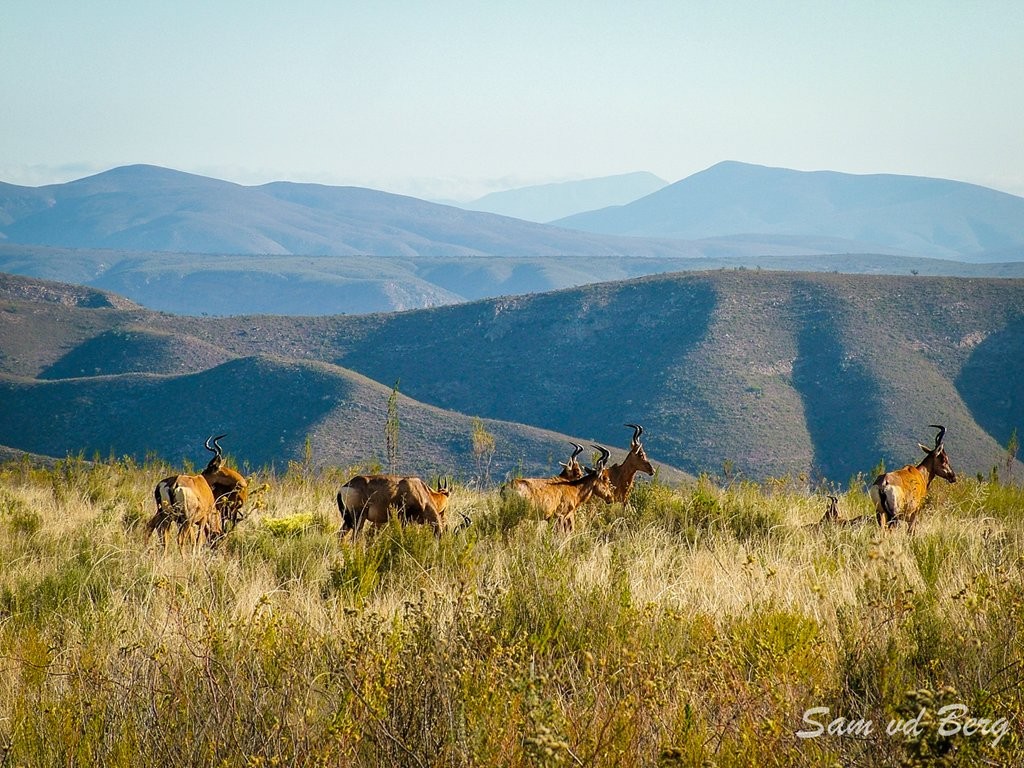 Bergplaas
On top of the pass, you are greeted by the extensive Bergplaas grassland plateau which affords panoramic views. This area is frequented by Red Hartebeest and is also the site of the Cape Mountain Zebra re-introductions. It also serves as a staging point for hiking trails into the Berg Plaatz Wilderness area. Mac Mountain (1582m) poses a moderate challenge to the experienced hiker.
Dry stone walls bear testimony to the endeavours of long-departed farming folk.
Winston le Roux's cable way system once bridged the gaping Waterpoort, providing an effective link between the Enkeldoorn and Bergplaas farming communities. Constructed in the early 1960's, the system was used to transport farm produce (wheat, potatoes, vegetables and livestock) between the two areas, by-passing the tortuous and time consuming road route. The view west gives an idea of the extent of the valley's fault line and the enormity of the forces which buckled the earth's crust.
After Bergplaas, the road descends Holgat Mountain Pass. Going down the pass, the slopes are covered in spekboom, aloes, valley bushveld euphorbia and mountain fynbos, with a sprinkling of proteas.
Prominent on the way down is the conical hill known as Langkop, set against the backdrop of the headwaters of the Kouga Dam.
 Fynbos - Bergplaas
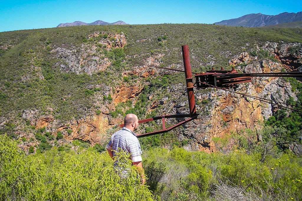 Winston le Roux's Cable Way
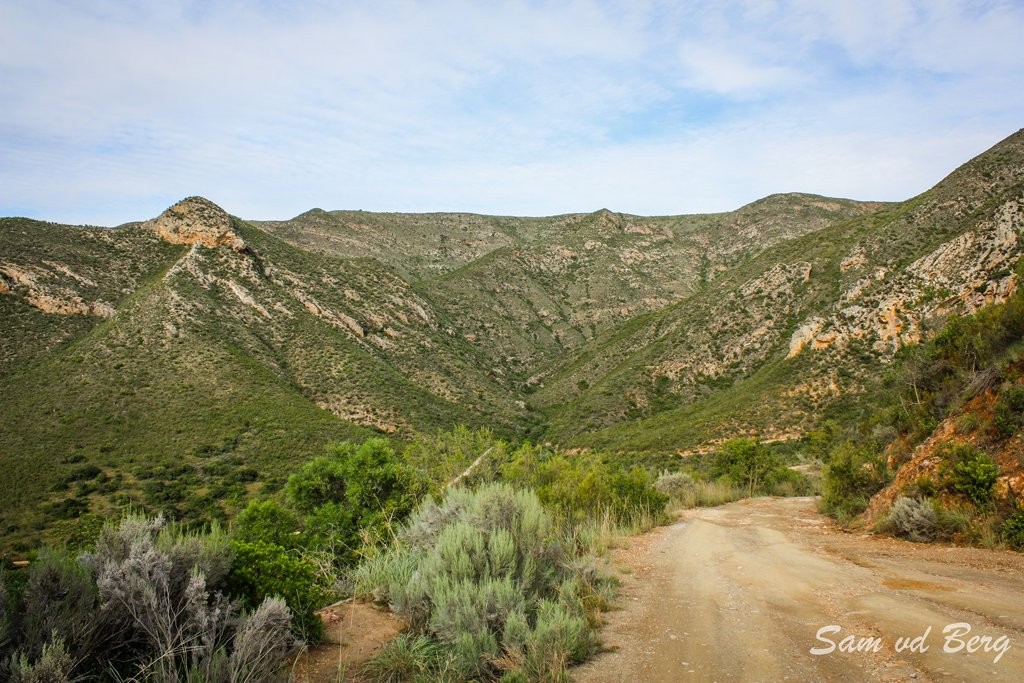 Holgat Pass
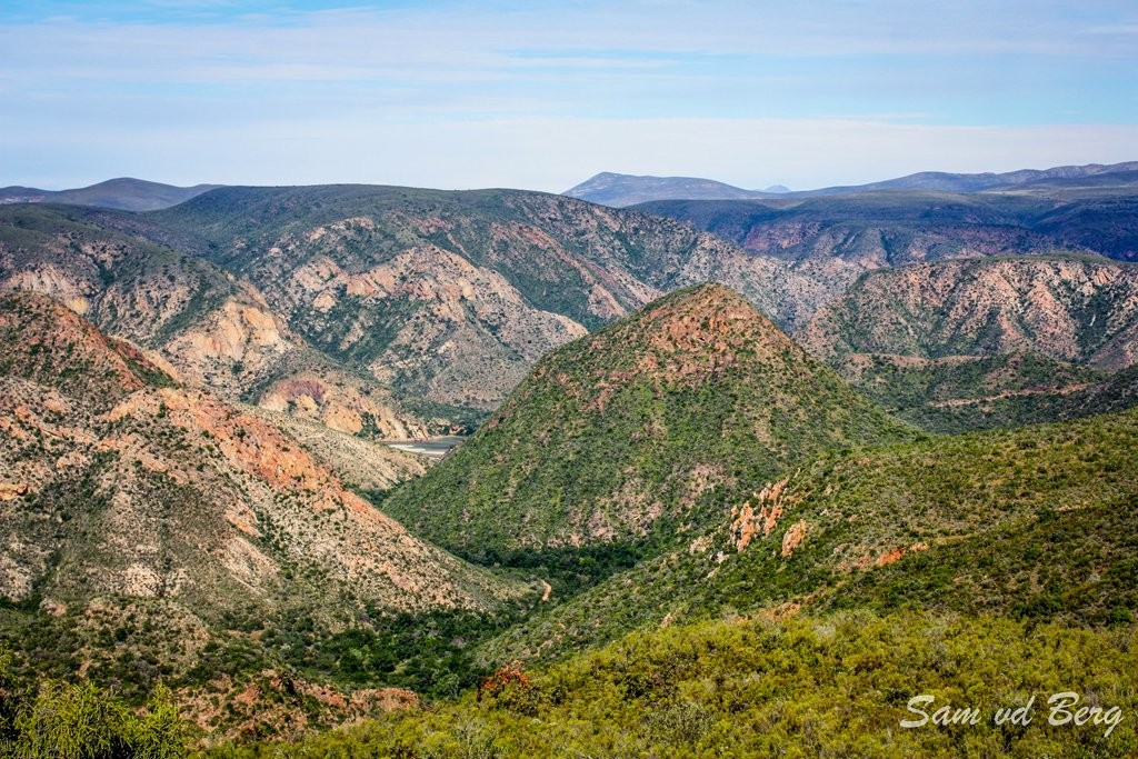 Langkop
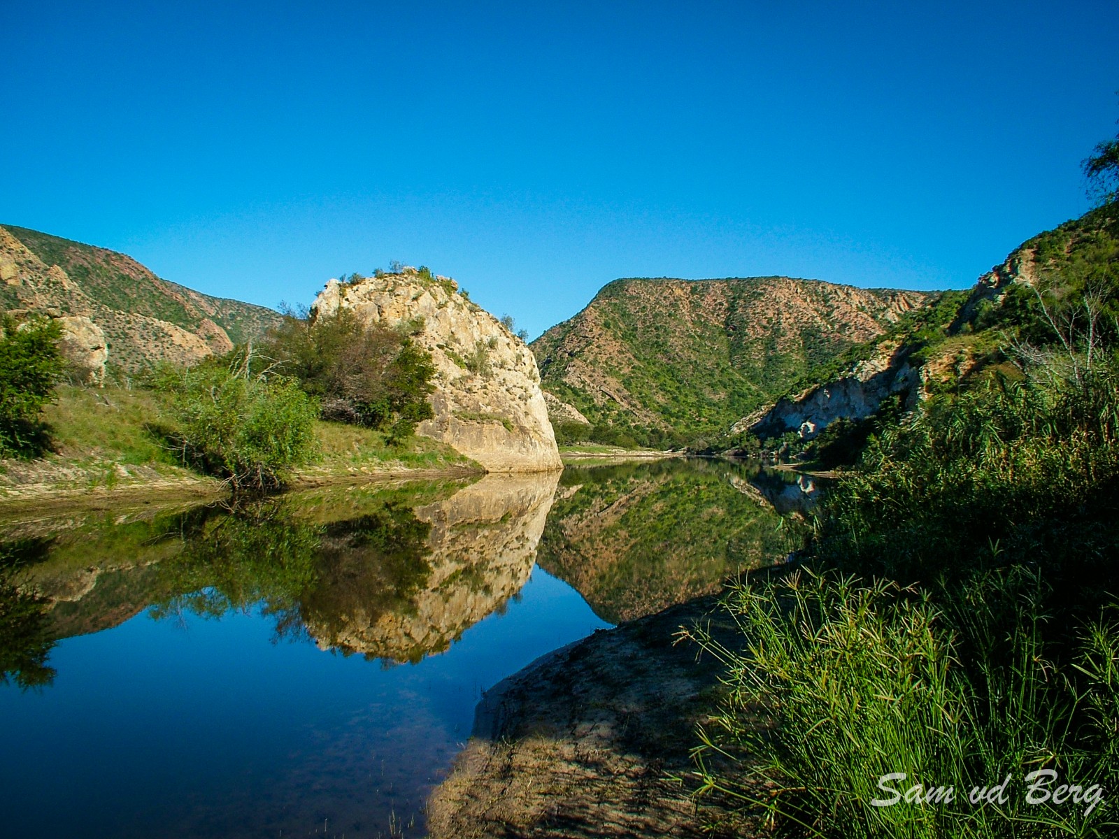 Doodsklip
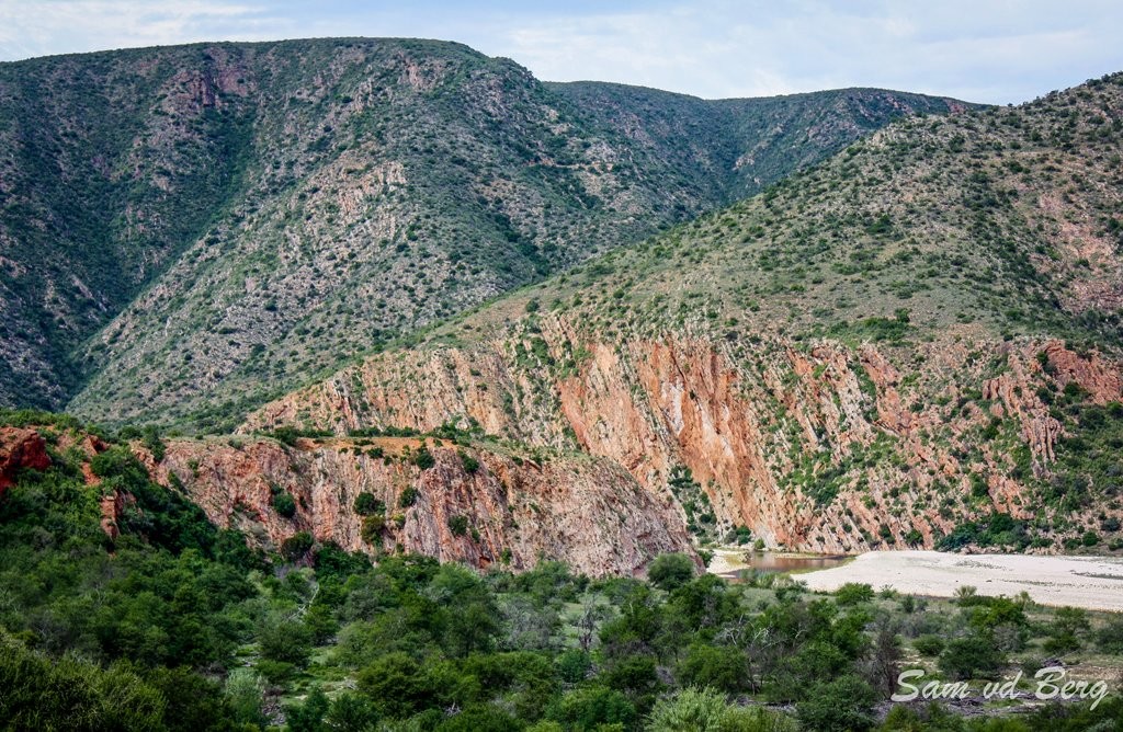 Rooihoek
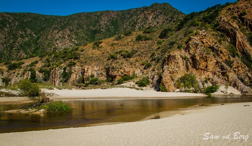 The Rooihoek Swimming Area
Located at the head of the Kouga Dam, the Doodsklip wilderness camping site provides opportunities for outdoor recreation. Originally known as Lemoentuin or Orange Grove, legend has it that certain individuals died under strange circumstances at the site, hence the present-day name. This area was extensively farmed up until 1970. The great flood of 1971 and buy-out initiatives by the state, related to the construction of the dam, put an end to active farming in the area. Currently it is a wilderness campsite with 5 campsites with pit latrines run by Eastern Cape Nature Conservation.
5km upstream from Doodsklip, the Rooihoek wilderness camping site (5 Campsites) sports a natural pool in the Kruisrivier fringed by an expansive stretch of white sandy beach. The pool was named after the patron of the area, Dr Allen Hydrant. The setting sun bathes the sheer rock walls in a warm, red glow, giving the area it’s name.
This area offers excellent opportunities for hiking, serving as an important trail-head for the Geurna and Berg Plaatz wilderness areas. The Kouga River canyon can also be explored from here which eventually exits at the Riverside Development Area in the Langkloof.
At the foot of the Grassneck Mountain Pass, nestled between the rock face and riverine vegetation, is a natural plunge pool for the traveler to cool off.
Ascending the Grassneck Pass, a backward glance will reveal wall-to-wall valley bush veld and the broad, gentle sweep of the Kouga-Baviaans floodplain, hemmed in by the impassive Kouga Mountains.
On reaching the summit of Grassneck Pass, the sentinels of the Baviaans Range come into view, with Scholtzberg (1 626m) dominating the skyline.
 Approaching Grassneck Pass
 Grassneck Pass
 Scholtzberg
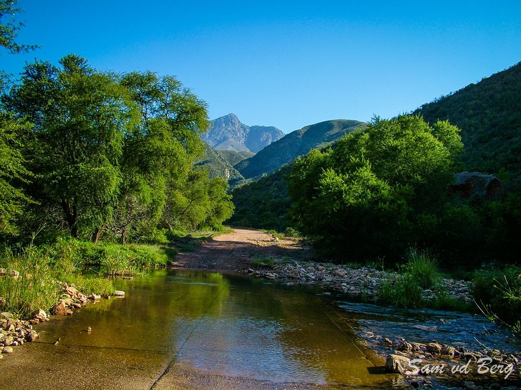 Scholtzberg
Roadside viewpoints offer stunning vistas of the entire area. After descending the pass one encounter the next crossing of the Baviaanskloof River at Apieskloof.
At Apieskloof the road runs for about 100 meters in the Baviaanskloof riverbed another place to cool off in summer.
Sandvlakte is the first privately owned farm after the Wilderness Area.
NUWEKLOOFPAS is a beautiful example of rock formations found in the Kloof, and is considered the official entrance into the Baviaanskloof from the west.
In places, the pass dips into the dry bed of the Baviaanskloof River and follows it as it twists through a deep gorge walled by sheer, russet cliffs.

Local opinion is divided on how RAASKRANS (noisy cliff) in the Nuwekloofpas got it's name. One version refers back to the first days of the automobile when drivers would hoot ahead of blind curves. Others say it describes the sound of gushing water.
It is said that when the BAVIAANSKLOOF KEY ("SLEUTEL") rock falls away from the cliff, the Kloof will be locked forever!

Visit the local tea garden with fresh vetkoek at RONDEKLIPPIES. Also fresh vegetalbles for sale and a lovey hiking trail.
Look out for these interesting rock formations, THE SEVEN DWARFS, along the road.

The uniquely built BAVIAANS CRAFT SHOP, selling crafts from the broader Baviaans area, is a must-see. With its living roof, the building itself is a piece of art. The shop is part of the Baviaans Community upliftment project.

During the Anglo-Boer war of 1899-1902, a skirmish between police and a group of aspiring Boer rebels took place in the area of VENSTERKLIP.

SEWEFONTEIN WILD FIG TREE FOREST is a beautiful and unique forest of old wild fig trees with a hiking trail and shady picnic spots.

Iconic Afrikaans writer, PH (PETER HENDRY) NORTJE, was born on the farm Klipfontein (now part of Sewefontein) at Studtis on 20 October 1920. Aside from setting several novels in the Baviaanskloof, some of his autobiographical works include anecdotes about life here. Possibly his best known book - The Wild Grape Tree (Die Wildedruif val) - a moving account of the devastating flood that swept through the Kloof, won a youth literature award from Sarie and Tafelberg.
ZAAIMANSHOEK is referred to as the "lost city" of Baviaans. A stroll through this tucked away community reveals true local culture and a community seemingly undisturbed by time.

The CAMPBELL MONUMENT was erected to commemorate the lives lost in the 1916 flood.

The first church to be established in the Kloof was the DUTCH REFORMED CHURCH. It was rebuilt at Gannaland-se-kloof on Zandvlakte in 1918 after the previous church washed away at Kleinpoort in the 1916 flood.

HIKING, MOUNTAIN BIKING, 4x4 ROUTES, birding and many other nature-related activities are offered by the various accommodation establishments in the Kloof.
- More InfoQueen Victoria - Rock FormationAt Andrieskraal (16 km from Patensie), the bust of Queen Victoria rises out of the cemented matrix of water-borne pebbles known as Enon conglomerate.
- Patensie Baviaanskloof East,
- Surrounding Areas
- Sightseeing
- 044 923 1702
- 083 420 5434
- info@baviaans.co.za
- More InfoThe Seven DwarfsLook out for these interesting rock formations – The Seven Dwarfs along the road.
- Baviaanskloof
- Sightseeing
- 044 923 1702
- 083 420 5434
- info@baviaans.co.za
- More InfoThe Leopard TrailThe Leopard Trail is a 4-day/3-night slack-packing hike. Logistically, this is the easiest hike you will ever do! Each day, we transport your bags and food from one overnight spot to the next. We provide all the cooking...
- Baviaanskloof
- Hiking Trails
- 074 939 4395
- 074 939 4395
- reservations@gobaviaans.co.za
- Visit Website
- More InfoCampbell MonumentThe Campell Monument was erected by the farming community to commemorate the lives lost in the 1916 flood.
- Baviaanskloof
- Sightseeing
- 044 923 1702
- 083 420 5434
- info@baviaans.co.za
- More InfoBaviaans - Kouga4x4 trail and travel routeThe baviaans-kouga4x4 trail is a unique travel experience for those visiting the Baviaanskloof region. it offers travellers an unique opportunity to enter the Baviaanskloof and the World heritage site on the only 4x4 trail that...
- Baviaanskloof
- 4x4 Trails
- 021 813 5883
- 0834911009
- rob@baviaanslodge.co.za
- Visit Website
- More InfoBaviaanskloof Dutch Reformed ChurchThe first church to be established in the Baviaanskloof was the Dutch Reformed Church. It was rebuilt at Gannaland-se-kloof on Zandvlakte in 1918 after the previous church washed away at Kleinpoort in the 1916 flood.
- Baviaanskloof
- Sightseeing
- 044 923 1702
- 083 420 5434
- info@baviaans.co.za
- More InfoKomdomo - Baviaanskloof Nature ReserveKomdomo - Baviaanskloof Nature Reserve Offices
- Patensie Baviaanskloof East,
- Surrounding Areas
- 042 283 0630
- More InfoVero's Restaurant and Craft Shop - In the ValleyVero's Restaurant offers travellers local cuisine such as roosterkoek with a variety of fillings. The restaurant is one of the few found in Baviaanskloof. The beautiful and very popular Baviaans Craft Shop built from organic...
- Baviaanskloof
- Shopping / Interests
- Curios / Arts / Crafts
- Restaurant
- Sightseeing
- 0783438182 Whatsapp
- More InfoNuwekloof Pass & Baviaanskloof SleutelNuwekloofpas is a beautiful example of rock formations found in the Kloof, and is considered the official entrance into the Baviaanskloof from the west.
- Baviaanskloof
- Sightseeing
- 044 923 1702
- 083 420 5434
- info@baviaans.co.za
- More InfoVensterklipDuring the Anglo-Boer war of 1899-1902, a skirmish between police and a group of aspiring Boer rebels took place in the area of Vensterklip.
- Baviaanskloof
- Sightseeing
- 044 923 1702
- 083 420 5434
- info@baviaans.co.za
- More InfoKouga DamThe dam is a double curvature arch dam 82 m high with a storage capacity of 128,7 million m3. Provision was made in the design to allow for a future raising of the water level by some 15,2 m. The construction of the wall marked...
- Surrounding Areas
- Sightseeing
- Dams
- More InfoSewefontein Wild Fig Tree ForestSewefontein Wild Fig Tree Forest is a forest of old wild fig trees with hiking trail and shady picnic spots.
- Baviaanskloof
- Sightseeing
- 0877010070